
SVAMITVA Yojana 2026: Property Card, Drone Survey, Eligibility, Benefits & Latest Update
Loading contents...
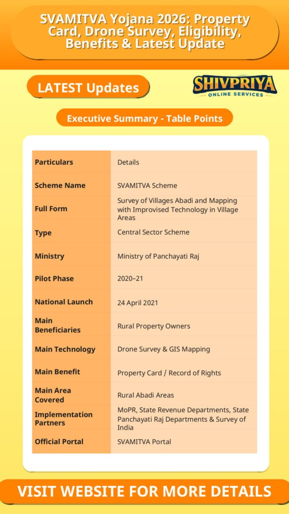
SVAMITVA Yojana भारत सरकार की एक महत्वपूर्ण Central Sector Scheme है, जिसका उद्देश्य ग्रामीण क्षेत्रों के inhabited/Abadi areas में रहने वाले लोगों को उनकी संपत्ति का स्पष्ट ownership record उपलब्ध कराना है।
SVAMITVA का पूरा नाम Survey of Villages and Mapping with Improvised Technology in Village Areas है। इस योजना में Drone Survey, GIS Mapping और modern surveying technology का इस्तेमाल करके गांवों की residential properties की mapping की जाती है और eligible property owners को Property Card / Record of Rights उपलब्ध कराया जाता है।
इस योजना का pilot phase 2020–21 में 9 राज्यों में शुरू हुआ था और इसे देशभर में 24 April 2021, National Panchayati Raj Day पर launch किया गया। योजना को Ministry of Panchayati Raj, State Revenue Department, State Panchayati Raj Department और Survey of India मिलकर implement करते हैं।
What is SVAMITVA Yojana?
ग्रामीण क्षेत्रों में कई properties का ownership और boundaries से संबंधित record पुराने, incomplete या अलग-अलग स्थानीय records में मौजूद हो सकता है। इससे property disputes, ownership verification और financial transactions में difficulties पैदा हो सकती हैं।
SVAMITVA का उद्देश्य ग्रामीण आबादी वाले क्षेत्रों की properties को accurately survey और map करके उनके ownership records को मजबूत करना है।
इसके लिए drone technology से aerial survey किया जाता है। Survey के आधार पर property boundaries और parcel maps तैयार किए जाते हैं और राज्य के निर्धारित legal/administrative process के अनुसार property owners को Property Cards जारी किए जाते हैं।
SVAMITVA Yojana के मुख्य उद्देश्य
योजना के प्रमुख objectives हैं:
- ग्रामीण residential properties का accurate survey करना।
- Property ownership records को स्पष्ट बनाना।
- ग्रामीण property owners को Property Cards उपलब्ध कराना।
- Property disputes को कम करने में मदद करना।
- ग्रामीण properties को financial asset के रूप में उपयोग करने का रास्ता आसान बनाना।
- Property के आधार पर institutional loans और अन्य financial benefits तक access में मदद करना।
- ग्राम पंचायतों के लिए बेहतर property-tax records तैयार करना।
- ग्रामीण planning के लिए accurate GIS maps तैयार करना।
- Gram Panchayat Development Plan (GPDP) को बेहतर बनाने में सहायता करना।
- ग्रामीण क्षेत्रों में modern surveying infrastructure विकसित करना।
SVAMITVA में Drone Survey कैसे होता है?
SVAMITVA की सबसे खास बात इसका drone-based mapping system है।
सामान्य प्रक्रिया को इस तरह समझ सकते हैं:
Drone Survey → Aerial Mapping → Property Boundary Identification → Map Preparation → Ground Verification/Enquiry → Property Record → Property Card
Drone से गांव के inhabited area की high-resolution imagery ली जाती है। इसके आधार पर individual properties और उनके boundaries को map किया जाता है।
इसके बाद तैयार maps और records को संबंधित state/local authorities के process के अनुसार verify और finalize किया जाता है।
Property Card क्या है?
SVAMITVA के तहत eligible rural property owner को Property Card / Record of Rights दिया जाता है।
यह card उस property से संबंधित ownership record को document करने में मदद करता है।
हालांकि, एक महत्वपूर्ण बात यह है कि Property Card की exact legal nature, format और evidentiary effect संबंधित State/UT के कानून और rules पर निर्भर कर सकता है। SVAMITVA portal भी अलग-अलग States/UTs के Property Card formats उपलब्ध कराता है।
इसलिए इसे हर राज्य में automatically एक जैसा “land title deed” मानना सही नहीं होगा।
SVAMITVA Property Card के Benefits
Property Card मिलने से rural property owners को कई practical benefits मिल सकते हैं।
1. Ownership Record
Property की ownership और boundaries से संबंधित official record तैयार करने में मदद मिलती है।
2. Property Disputes में कमी
Accurate mapping से property boundaries और ownership-related disputes को कम करने में सहायता मिल सकती है।
3. Loan के लिए Property का उपयोग
Property को financial asset के रूप में इस्तेमाल करके eligible financial institutions से loan/financial services प्राप्त करने का रास्ता आसान हो सकता है, subject to applicable state laws and lender requirements।
4. Property Tax Records
Accurate property mapping से Gram Panchayat या संबंधित authorities को property-tax assessment और collection में मदद मिल सकती है।
5. Better Rural Planning
GIS-based maps का उपयोग village-level infrastructure और development planning में किया जा सकता है।
SVAMITVA Scheme में कौन लाभार्थी है?
SVAMITVA मुख्य रूप से rural inhabited/Abadi areas के property owners को target करती है।
इसमें village residential areas की properties का survey और mapping किया जाता है।
यह scheme सामान्य agricultural land ownership scheme नहीं है। इसका प्रमुख focus rural Abadi areas की properties पर है।
इसलिए किसी व्यक्ति के पास केवल agricultural land होने से वह automatically SVAMITVA Property Card का beneficiary नहीं बन जाता।
SVAMITVA में कौन-सी Properties Survey होती हैं?
योजना का मुख्य focus है:
Rural Abadi / inhabited areas
यानी गांव के वे residential/in-habited areas जहां लोग अपने घर और अन्य संबंधित properties रखते हैं।
Survey के दौरान property parcels और village assets को digital mapping framework में capture किया जाता है।
क्या SVAMITVA में Individual Online Apply कर सकता है?
SVAMITVA को सामान्य individual application-based cash-benefit scheme की तरह नहीं समझना चाहिए।
इसमें village-level survey, mapping, verification और state revenue/administrative process महत्वपूर्ण भूमिका निभाते हैं।
यदि किसी गांव में SVAMITVA survey चल रहा है, तो property owners को संबंधित local authorities द्वारा survey/enquiry/verification process में शामिल किया जा सकता है।
इसलिए केवल online form भरकर कोई व्यक्ति तुरंत Property Card प्राप्त नहीं करता।
SVAMITVA Scheme Implementation
योजना के implementation में कई government agencies मिलकर काम करती हैं:
Ministry of Panchayati Raj
National-level coordination और scheme framework में मुख्य भूमिका।
State Revenue Department
Property records और state-level revenue/legal processes से संबंधित भूमिका।
State Panchayati Raj Department
Gram Panchayat और local-level implementation में सहयोग।
Survey of India
Surveying और geospatial mapping से संबंधित technical support।
CORS Network क्या है?
SVAMITVA में high-accuracy surveying के लिए Continuously Operating Reference Stations (CORS) network का भी उपयोग किया जाता है।
CORS technology precise geospatial positioning में मदद करती है और drone survey तथा mapping की accuracy improve करने में उपयोगी है।
SVAMITVA framework में CORS network की establishment को scheme के important technical components में शामिल किया गया है।
SVAMITVA और Gram Panchayat Planning
SVAMITVA से तैयार GIS maps का उपयोग केवल property ownership के लिए ही नहीं किया जा सकता।
इन maps की मदद से Gram Panchayat को:
- Roads
- Drainage
- Water supply
- Public infrastructure
- Community assets
- Property tax
- Village development planning
जैसे क्षेत्रों में बेहतर planning करने में सहायता मिल सकती है।
योजना के objectives में better-quality Gram Panchayat Development Plans (GPDPs) तैयार करने में GIS maps के उपयोग को भी शामिल किया गया है।
SVAMITVA और Property Disputes
ग्रामीण क्षेत्रों में property boundary और ownership को लेकर disputes लंबे समय तक चल सकते हैं।
SVAMITVA का accurate survey और mapping approach इन disputes को कम करने में मदद कर सकता है क्योंकि property boundaries और parcel information का digital record तैयार होता है।
हालांकि, Property Card अपने-आप हर प्रकार के legal dispute को समाप्त नहीं करता। विवाद की स्थिति में applicable state law और competent authority/court की प्रक्रिया लागू होगी।
SVAMITVA से ग्रामीण अर्थव्यवस्था को क्या लाभ?
इस scheme का broader objective rural property को एक productive financial asset के रूप में enable करना है।
जब property ownership records अधिक स्पष्ट और accessible होते हैं, तो property owners के लिए formal financial institutions से credit लेने की possibilities बेहतर हो सकती हैं।
इसके साथ property tax records और local planning में सुधार होने से Gram Panchayats की financial और administrative capacity को भी मजबूत करने में मदद मिल सकती है।
SVAMITVA Scheme में कितने Villages और Properties Covered हैं?
SVAMITVA का official dashboard लगातार update होता रहता है।
Official portal पर वर्तमान dashboard में 3.27 लाख से अधिक villages में drone surveys completed, 2.89 लाख से अधिक villages के maps states को handed over, और 11.26 करोड़ से अधिक parcels digitised दिखाए गए हैं।
Property-card data में official portal पर 2.83 करोड़ से अधिक property cards prepared का आंकड़ा भी उपलब्ध है।
ये आंकड़े field-level agencies द्वारा portal पर update किए जाते हैं, इसलिए समय के साथ बदल सकते हैं।
SVAMITVA Scheme Latest Update 2026
2026 में SVAMITVA scheme का implementation और property-card preparation/distribution process जारी है।
Ministry of Panchayati Raj का official SVAMITVA portal अभी भी live dashboard के माध्यम से drone surveys, digitised parcels, maps handed over, property cards prepared और distributed cards के updated statistics उपलब्ध करा रहा है।
Ministry of Panchayati Raj की official website पर SVAMITVA को अभी भी प्रमुख national programmes में शामिल किया गया है और ministry website July 2026 में updated है।
इसलिए 2026 में SVAMITVA को ongoing rural property-mapping and ownership-record initiative के रूप में describe करना उचित है।
SVAMITVA Yojana के Major Benefits
Rural Property Owners के लिए
- Property ownership record में clarity
- Property boundaries की digital mapping
- Property Card
- Property disputes कम करने में सहायता
- Formal credit तक access में मदद
- Property को financial asset के रूप में उपयोग करने की संभावना
Gram Panchayats के लिए
- Accurate property database
- Property-tax assessment में सहायता
- Better village planning
- GIS-based development planning
- Public assets की बेहतर mapping
Government के लिए
- Digital rural property records
- Accurate spatial data
- Better revenue administration
- Improved rural planning
- Modern survey infrastructure
SVAMITVA Scheme की खास बातें
- यह Central Sector Scheme है।
- Ministry of Panchayati Raj इसका national-level implementing ministry है।
- Pilot phase 2020–21 में शुरू हुआ।
- Nationwide launch 24 April 2021 को हुआ।
- Drone technology का उपयोग किया जाता है।
- GIS और CORS technology को survey framework में शामिल किया गया है।
- Rural Abadi areas इसका मुख्य focus हैं।
- Property owners को Property Cards/Record of Rights उपलब्ध कराने का उद्देश्य है।
- State Revenue और Panchayati Raj Departments implementation में महत्वपूर्ण हैं।
- Survey of India technical partner है।
- Property records को financial services और rural planning से जोड़ने का उद्देश्य है।
Madhya Pradesh में SVAMITVA
Madhya Pradesh SVAMITVA के implementation वाले राज्यों में शामिल है।
Official SVAMITVA portal पर Madhya Pradesh के लिए अलग Property Card Format भी उपलब्ध है, जो यह दिखाता है कि राज्य scheme के property-record framework में शामिल है।
MP में किसी specific village की survey या Property Card status जानने के लिए SVAMITVA dashboard और संबंधित local/state revenue authorities के records देखना अधिक उचित रहेगा।
Frequently Asked Questions (FAQs)
SVAMITVA Yojana क्या है?
SVAMITVA भारत सरकार की Central Sector Scheme है, जिसके तहत rural Abadi areas की properties का drone और GIS technology से survey करके property ownership records और Property Cards तैयार किए जाते हैं।
SVAMITVA का Full Form क्या है?
Survey of Villages Abadi and Mapping with Improvised Technology in Village Areas.
SVAMITVA Yojana कब शुरू हुई?
इसका pilot 2020–21 में शुरू हुआ और nationwide launch 24 April 2021 को National Panchayati Raj Day पर किया गया।
SVAMITVA Property Card क्या है?
यह rural property से संबंधित ownership/Record of Rights को document करने वाला card है, जिसकी format और legal treatment संबंधित State/UT के rules पर निर्भर कर सकती है।
क्या SVAMITVA में agricultural land भी शामिल है?
Scheme का primary focus rural inhabited/Abadi areas की properties पर है। इसे सामान्य agricultural land-survey scheme नहीं माना जाना चाहिए।
क्या Property Card से loan मिल सकता है?
Property Card rural property को financial asset के रूप में उपयोग करने में मदद कर सकता है और eligible owners के लिए loan access आसान हो सकता है, लेकिन loan approval bank/lender की eligibility, applicable state laws और lending conditions पर निर्भर करता है।
क्या SVAMITVA में कोई cash benefit मिलता है?
नहीं। यह direct cash-transfer scheme नहीं है। इसका मुख्य benefit property mapping और ownership documentation है।
क्या कोई व्यक्ति खुद online SVAMITVA के लिए apply कर सकता है?
यह सामान्य individual subsidy/application scheme नहीं है। Survey और Property Card preparation village/state-level administrative process के माध्यम से किया जाता है।
SVAMITVA में drone का इस्तेमाल क्यों किया जाता है?
Drone से rural Abadi areas की high-resolution aerial imagery लेकर property boundaries और parcels की accurate digital mapping करने में मदद मिलती है।
SVAMITVA Scheme 2026 में जारी है?
हाँ। Official SVAMITVA portal 2026 में भी ongoing survey, digitisation और Property Card-related progress के updated figures दिखा रहा है।
Conclusion
SVAMITVA Yojana 2026 ग्रामीण भारत में property ownership और land-record management को modern technology से मजबूत करने की एक महत्वपूर्ण पहल है। इसका सबसे बड़ा focus rural Abadi areas की properties का accurate drone-based survey, GIS mapping और Property Cards के माध्यम से ownership records को स्पष्ट करना है।
इस योजना से property disputes को कम करने, rural property को financial asset के रूप में उपयोग करने, property-tax records सुधारने और Gram Panchayat की development planning को बेहतर बनाने में सहायता मिल सकती है।
Official dashboard के अनुसार scheme के तहत लाखों villages का drone survey और करोड़ों property parcels का digitisation हो चुका है, जबकि Property Card preparation और distribution का काम भी लगातार जारी है।
Official SVAMITVA Portal: SVAMITVA Official Website
Ministry of Panchayati Raj: Ministry of Panchayati Raj – SVAMITVA
| Particulars | Details |
| Scheme Name | SVAMITVA Scheme |
| Full Form | Survey of Villages Abadi and Mapping with Improvised Technology in Village Areas |
| Type | Central Sector Scheme |
| Ministry | Ministry of Panchayati Raj |
| Pilot Phase | 2020–21 |
| National Launch | 24 April 2021 |
| Main Beneficiaries | Rural Property Owners |
| Main Technology | Drone Survey & GIS Mapping |
| Main Benefit | Property Card / Record of Rights |
| Main Area Covered | Rural Abadi Areas |
| Implementation Partners | MoPR, State Revenue Departments, State Panchayati Raj Departments & Survey of India |
| Official Portal | SVAMITVA Portal |
Disclaimer
Yeh job post sirf informational purpose ke liye banayi gayi hai taaki aapko recruitment ki details simple aur samajhne layak format me mil sake.
Time ke saath details me changes ho sakte hain (jaise dates, vacancies, eligibility, etc.). Isliye apply karne se pehle official notification ko zarur verify karein.
Hum kisi bhi typing error, outdated information ya misunderstanding ke liye zimmedar nahi honge.